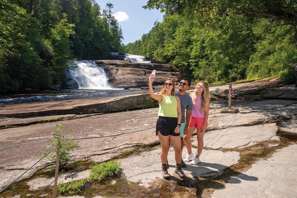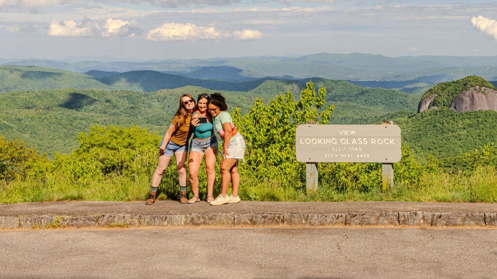
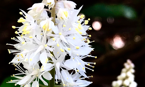
Take a Walk on the Wildflower Side
Some hiking trails offer big surprises – like hidden waterfalls or dramatic vistas – but some offer smaller, more intimate experiences that can be equally satisfying. Throughout the Blue Ridge Mountains, and specifically in Transylvania County, a wide variety of wildflowers lend vibrant color to our coves and hollows from early spring to late autumn. We talked to two wildflower experts, Rosemarie Shannon Knoll and Marianne Weaver to come up with four outstanding wildflower hikes where you are likely to see some great examples of Mother Nature as landscape artist.
A Kind Reminder
DO NOT PICK THE FLOWERS. Remember, you are a guest on public land. It is illegal to pick wildflowers, and many are protected species.
Pro Tip
A good wildflower guide is an ideal companion for these walks. There are several excellent guides available, but we’re partial to Rosemarie Shannon Knoll’s superb series, which includes Wildflowers of the Blue Ridge Parkway and Pisgah National Forest, Wildflower Quick Reference Guide, and Wildflowers and Waterfalls of DuPont State Recreational Forest. All three titles are available at High Falls Publishing.
Art Loeb Trail
Pisgah National Forest
An easy out and back walk of two miles, this spring wildflower walk is close to the entrance of Pisgah National Forest near the Davidson River Campground. The path follows the Art Loeb Trail along the Davidson River.
WHAT MAKES IT SPECIAL
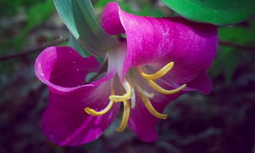
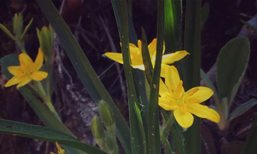
According to Rosemarie: “This easy to walk trail is covered with a beautiful carpet of wildflowers in April and May including Trillium, Bloodroot, Toothwort, and a variety of Violets. You will also see Mayapple, Trout Lily, Little Brown Jug, and Foamflower. The Art Loeb Trail connects with the Estatoe Trail for those who want to walk further along the river. The Estatoe Trail is known for its rock walls covered with mosses and lichens.
DIRECTIONS TO TRAILHEAD
From the entrance of Pisgah National Forest drive one mile on US276. Turn left towards the Davidson River Campground and take an immediate left into the Art Loeb Trailhead parking lot. Park here and follow the signs to the Art Loeb Trail at the far end of the parking area.
TIP
The most abundant area of wildflowers starts about 0.2 miles from the parking area, where the trail crosses the Davidson River on a pedestrian bridge. From here to the junction with the Estatoe Trail is a little over 1 mile of beautiful spring wildflowers.
Cat Gap Loop
Pisgah National Forest
A moderate out and back hike of 2.5 miles that begins at the trailhead for Cat Gap Loop at the Pisgah Center for Wildlife Education and Bobby M. Setzer State Fish Hatchery. The trail winds along the Davidson River with several rustic wood footbridges and small, rocky stream crossings.
WHAT MAKES IT SPECIAL
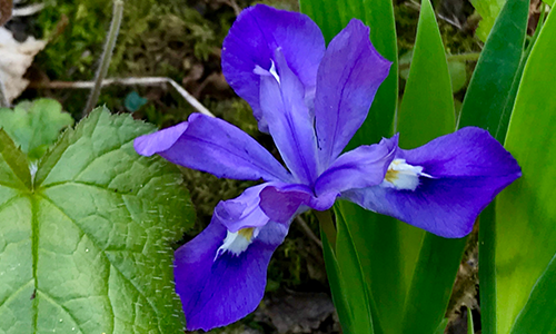
According to Rosemarie: “The highlight of this trail is the wide variety of wildflowers that can be seen from spring through summer. Spring wildflowers include Wild Geranium, Trillium Grandiflorum, and Thymeleaf Bluets. Be sure to peek under the plant’s leaves to see the flowers of Mayapple, Catesby’s Trillium and Yellow Fairybells. Numerous large Carolina Silverbell trees drop their flowers along the trail in spring. Summer brings the bright red fruit of Hearts-a-Bustin’ and Jack-in-the-Pulpit along with large clusters of white to pink flowers of the Great, or Rosebay Rhododendron.”
DIRECTIONS TO TRAILHEAD
From the entrance of Pisgah National Forest drive 5 miles on US276. Turn left on 475 and drive 1.4 miles to the Pisgah Center for Wildlife Education and the Bobby M. Setzer State Fish Hatchery. Park here and follow the signs to Cat Gap Loop at the east end of the parking area.
TIP
Bring a hiking stick to help with crossing the small, rocky streams. The most abundant wildflowers are along the Davidson River from the beginning of Cat Gap Loop to the trail to John Rock, which is about 1.4 miles. Turn around here to return to the parking area. Hardy hikers can continue another 3 miles on Cat Gap Loop as it ascends up and around John Rock.
Twin Falls Trail
Pisgah National Forest
A moderate out and back hike of 4.5 miles, this waterfall and wildflower adventure follows the Avery Creek and Buckhorn Gap Trails and ends at 100 ft. tall Twin Falls.
WHAT MAKES IT SPECIAL
According to Marianne: “The spring wildflowers are beautiful – I see more Jack-in-the-Pulpits on this trail than any other of my favorite hikes and there are always beautiful Vasey’s Trillium near the waterfall. Depending on the timing, you might see Mayapples, Trout Lilies and many others. I’ve taken many wildflower photos on this trail over the last few years and will often hike the trail a couple of times to make sure I don’t miss the Trilliums.”
DIRECTIONS TO TRAILHEAD
Take US276 into Pisgah Forest. At 2.50 miles, turn right on Forest Service Road 477 (gravel). Drive 2.6 miles and park in a small parking area just past the Pisgah Forest Riding Stables.
TIP
Follow the blue and orange blazes of the Avery Creek and Buckhorn Gap trails to reach your destination.
Rainbow Falls Trail
Gorges State Park
A moderate hike of 3.5 miles that begins in Gorges State Park and passes into Pisgah National Forest. The trail culminates at the Horsepasture River and a series of falls, including magnificent 150-foot Rainbow Falls and soothing Turtleback Falls.
WHAT MAKES IT SPECIAL
According to Marianne: “The highlight of this trail is, of course, the 150-ft Rainbow Falls. And, when your timing is just right you can get beautiful photos of the rainbow in front of the falls. As you ascend beyond Rainbow Falls toward Turtleback Falls there is an area with Catesby’s Trilliums, Solomon Seals and Fairy Wands. These are quite magical and I’ve only seen them on one other trail.”
DIRECTIONS TO TRAILHEAD
From the entrance of Gorges State Park proceed by car to the Grassy Ridge Trailhead.
TIP
While there is ample parking at the Grassy Ridge Trailhead, this is a busy trail and we advise you to arrive early.